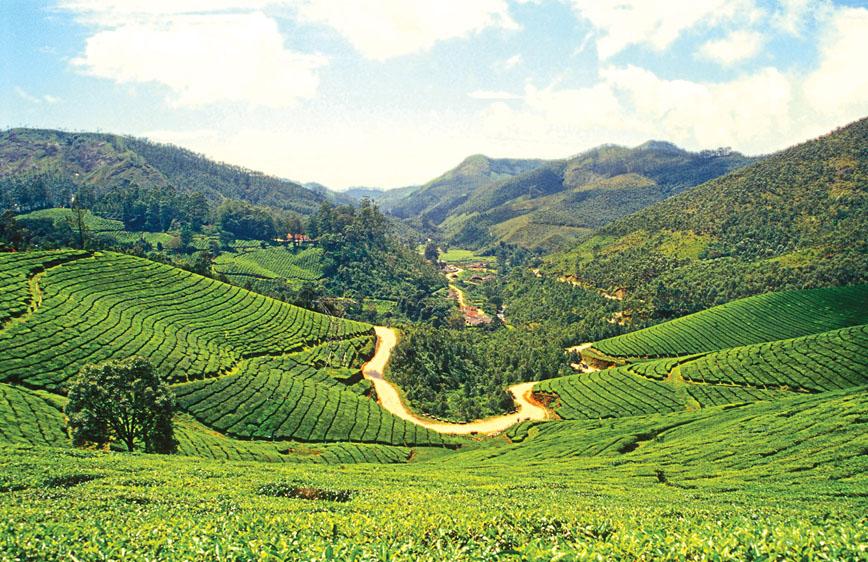
Go trekking in Munnar in the heart of tea country
Susheela Nair, Munnar
We received a green carpet welcome as we entered the tea town of Munnar. There were manicured tea bushes all around and the air was filled with the fragrance of tea. Situated at the confluence of three streams which congregate at the heart of the town in the High Ranges, Munnar (pronounced Moonaar) means three rivers in local parlance. Every nook and crany of Munnar is endowed with alluring natural beauty which can be explored at your own pace.
There are picnic spots at each bend of meandering roads and innumerable hiking trails to explore. You can frolic under roaring cascades of water or tee off in tea country. Exploring the town itself is a delight. Interestingly, perched on three hillocks, overlooking the centre of town, are three major religious places of worship — the Murugan Temple, Mount Carmel Church and Muslim Jamath, testifying to Munnar’s tradition of communal harmony and peaceful coexistence.
Then there is India’s first Tea Museum, located on a tea estate which is more than 100 years old. You can delve into the history of the tea tradition in the High Ranges here. At the entrance, a sundial catches the eye. The memorabilia preserved inside include photos, curios and other tea paraphernalia. There is also the EPABX of a 1909 telephone system as well as other items from the colonial era. A mini tea-manufacturing and tea-tasting unit offer glimpses of the different aspects of tea processing. You can see the original 1905 tea roller, the rotor vane, the Pelton wheel of the 1920s and a rail engine wheel of the Kundale Valley Railway.
There are several road trips one can make out of Munnar through some far-flung tea estates. The drive to the dams of Mattupetty, Kundale and to Top Station, perched precariously on a precipitous ridge in Tamil Nadu, is pretty interesting. This idyllic spot has stupendous views over the Tamil Nadu plains and the edge of the Western Ghats. En route, we screamed our lungs out at Echo Point and took a cruise in the picturesque backwaters of the Mattupetty Dam, flanked by steep hills and dense woods. We glimpsed wild elephants quenching their thirst on the far side. From Mattupetty, we drove four kilometres along Top Station Road to Sethuparvathipuram Dam (or Kundale Dam), located in Kundale.
The waterfalls and their enchanting environs leading to excellent picnic spots and trekking routes are at their glorious best immediately after the monsoon. The most popular trail is through a valley of rhododendrons and pine forests to Meesapulimala, the second highest point in the High Ranges. On the way to Thekkady, we stopped by Power House Waterfalls which cascade down a steep rock 2,000 metres above sea level. Athukal, located between Munnar and Pallivasal, is a feast for the eyes. Nyayamakad is a land of breathtaking waterfalls. The waters tumble down from a height of about 1,600 metres. The Vallara and Cheeyampara Falls, located close to the National Highway on the Adimali-Munnar route, are a sight to behold during the monsoon.
The highlight of our trip was a bone-rattling Jeep ride from Munnar to Kolukkumalai, located in the upper reaches of Tamil Nadu’s Theni district close to the Kerala border, at an elevation of 7,900 feet above sea level. It is acclaimed as the world’s highest tea plantation, growing ‘the most flavoursome tea in the market’. Other bonuses include awesome views of the sweltering plains of Tamil Nadu.
There is a path that was once used by estate workers to ferry tea chests to the plains and provisions back to the top. We set out on a guided tour of the tea factory to understand the various aspects of orthodox tea processing and were treated to piping hot tea at the end of the factory visit. What gives Kolukkumalai tea a special flavour is presumably the high altitude at which it grows.
As we ascended the steep slopes of Eravikulam National Park, Anaimudi (8,841 feet), the highest peak in South India, loomed in the distance. The undulating rolling grasslands and wooded valleys of the Eravikulam National Park house one-third of the world’s population of Nilgiri Tahr, a highly endangered animal which roams freely within touching distance. Once in 12 years, cascades of neelakurinji blossoms spill down the slopes. We followed in the footsteps of the nimble-footed wild goats and found them foraging for grass. The frisky young ones gambolled up and down the slopes.
A 20-km drive from Marayoor on the Rajamala-Udumalpet Road (SH-17) took us to the Chinnar Wildlife Sanctuary, a unique protected area in the Western Ghats due to its ecological, floral, geomorphological and cultural significance. The star attractions of Chinnar are the grizzly giant squirrel and the endangered star tortoise. There
are dolmens in Chinnar also. We culminated our trip with a drive to Kanthaloor village, known
for its luscious apples, sugarcane fields and
terrace cultivation. n
Fact File
How to get there
Air: Nearest airport is Nedumassery (Kochi) – 121 km (4 hours).
Rail: Nearest railhead is Aluva (120 km).
Road: Aluva is 120 km away, Palakkad is 150 km away.
When to go: September to May-end. If you want a monsoon break, June, July and August are ideal.
Tourist information office: District Tourism Promotion Council (www.munnartourism.com)


