

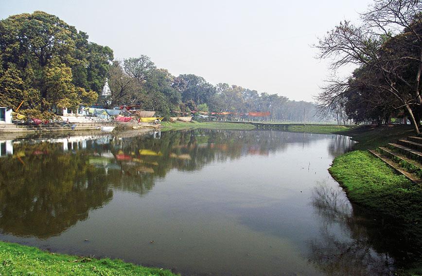
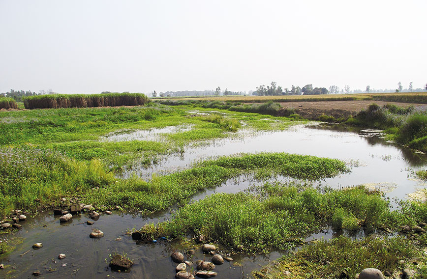
The Fulhar Jheel, no better than a pond, is considered the source of the Gomti
On the trail of the Gomti
By Venkatesh Dutta
IT was in early spring of 2011 that I decided to walk along the course of the Gomti from its origin to its confluence with the Ganga. An informal group was created with students, retired engineers and river enthusiasts. We developed a code of conduct for our river journey: we would not take any funding and would only stay close to the river, drawing inspiration from Vinoba Bhave walking across India in search of land for the landless.
It took us 10 days to complete a journey of 960 km. We started from Pilibhit and ended at Ghazipur near Varanasi. Nowhere did we stay in hotels. Villages, temples and gurudwaras close to the riverbank were where we made night halts. In one day, we used to visit up to five villages to do a ground assessment of the river.
We went to the headstream of the Gomti in Pilibhit district only to discover that the river had disappeared about 50 km from its origin. There was just a small pond there called Fulhar Jheel, which was considered the source of the river. Downstream from this pond were fragmented and isolated ponds interspersed with farmlands of paddy and sugarcane grown on the erstwhile riverbed.
It was a shocking revelation. The land that belonged to the river was now in the name of private landholders. How could this happen, I asked myself. How was the river’s lifeline marginalized and forgotten to the brink of desertion? Even the length of the river and its various tributaries were not recorded correctly in the official documents.
Uttar Pradesh’s water resources are bountiful. The Gomti is one of eight major perennial rivers — the others being the Ganga, Yamuna, Ramganga, Ghaghra, Rapti, Gandak and Sone.
Keeping these rivers alive and healthy needs to be a national priority especially in the face of the upcoming challenges thrown up by global warming. Reviving the Gomti was to us as good a place as any to begin.
For the first time, we mapped all the tributaries of the Gomti, using older satellite pictures. Many rivers were not even mentioned in land records and were missing. What followed was a series of visits to land revenue departments and the office of the collector. Apart from articles in journals, many stories on our findings were written in newspapers. A Hindi daily carried one such story on its front page with a headline —‘Lekhpalon ne bech dali Gomti ’ (Gomti sold by Lekhpals).
An aerial survey was done by the then cabinet minister based on the reports documenting our findings in various newspapers. A committee was formed to prepare a restoration plan under the control of the irrigation department with its headquarters in Lucknow.
MAPS, PONDS AND POLITICS
River restoration became a political agenda. During the 2013 Assembly elections, full-page ads were carried in prominent newspapers claiming that the Gomti would be restored.
However, the project report became the starting point of a destructive riverfront project in Lucknow, with some ad hoc work upstream of the Gomti in Pilibhit district. During the past decade, many district magistrates came and went but no one began the process of cancelling the lease or the private land holdings on the riverbed.
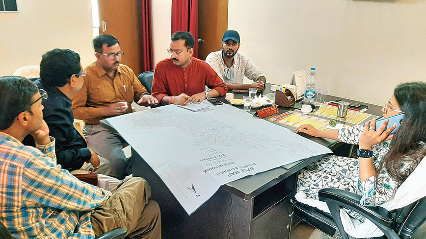 Developing a drainage map is the first step in restoration. Meeting with the Chief Development Officer and MGNREGA team in Bahraich district
During the past two years, a channel of almost 50 km was cut with JCB machines but at many places the width of the river has been confined to a few metres. An informal compromise has been reached between farmers and the district authorities and only a small channel has been left in the name of the river.
Many water bodies were given on patta (lease) to fishermen and farmers four decades ago. Over time, due to destruction of the ponds’ catchment areas by roads, highways and bridges, these water bodies became seasonal. When they dried up, farmers started cultivating on their beds. And now they claim rights over these lands. The land revenue department does not care to reverse these land holdings and restore them as water bodies. This is happening everywhere in the state, even in other river basins.
A letter was issued by the chief secretary of Uttar Pradesh to all district magistrates on June 2, 2022, to designate 100 metres from the edge of the river as a no-development/construction zone. This direction was also extended to smaller rivers and tributaries of the Ganga. The district magistrates have been asked to ensure that the 100-m zone on both sides of the banks remain free from encroachment and construction.
This requires zoning of every river — many smaller rivers have been encroached upon by farmlands and illegal construction. In some cases, these lands were given to individuals by the revenue department without realizing that they belong to rivers. Getting them back is a big challenge.
We have made several presentations to district officials and engineers involved in the restoration of rivers and smaller streams. During our numerous meetings and field visits, we have stressed phase-wise restoration work with three steps in the beginning:
- Identification and marking of encroachment on the two-km buffer on both sides of the river using revenue/cadastral maps
- Classification of the critical stretches of the river which need immediate attention such as obstruction, fragmentation, etc. and
- Marking of ‘origin points’ of rivers or minor streams as well as ‘confluence points’ with the ‘major river’ in the respective districts for special conservation zoning and priorities.
These three things are critical for taking up the task of restoration without which the work will not be fruitful. We have only achieved limited success. Much more needs to be done.
DREDGING ISN’T RESTORATION
Ongoing mainstream work on river rejuvenation is not only short-sighted but also eerily pernicious. River dredging is not river restoration. Currently, this work is converting natural drains or smaller rivers into sewage carrying channels and even legitimizing them as nullahs. Sewage treatment plants (STPs) are being installed without putting in place a robust mechanism of maintenance and monitoring. Who will ensure the treated water meets compliance? Pollution control boards have poor monitoring mechanisms.
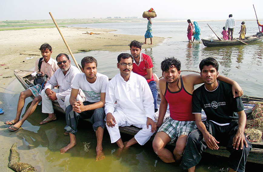 The Gomti team at Kaithi
River rejuvenation is not a magic formula. Revival of rivers will take at least 10 to 15 years as overexploitation of groundwater by urban citizens and farmers needs to be minimized. Base flow must be maintained and restored and connectivity with any major river is to be evaluated and more. The IITs and other institutions should undertake complete mapping of fluvial geomorphology in the entire Ganga basin. That will create new understanding on surface and groundwater interface.
We have requested maintenance of slopes while digging or desilting, especially when doing it with machines. This will maintain upstream-downstream connectivity. If some pockets are deeply excavated and incised, it will attract algal growth during the lean seasons.
While desilting, silt management is the most crucial step. It was observed that excavated sand-silt was used as bunds (as high as four to five feet), which will not allow water from catchments to come to the river channel. Secondly, the silt material will gradually come back to the river. River-bed materials should not be used to make bunds for smaller rivers. Instead, the natural slope and terrain of the landscape with a gentle valley slope should be retained. Arrangement for disposal of silt materials for other purposes can be made.
Similarly, the incision or excavation of a dry and silted river channel should be made as per the required channel width with distinct river terraces. If the channel width is less, then the depth of the channel should also be less, ideally in proportion to the width. There are cases where the channel width is very little but its depth has been increased with deep excavation. The river looks like an artificial canal. This must not be done.
POLLUTION AND A TRICKLE OF WATER
Nearly 1,000 km of the Ganga passes through UP. It has almost 21 percent of India’s renewable water resources, though with uneven regional distribution and vulnerability to extreme floods and drought.
The state takes up 7.33 percent of India’s land but has 16.17 percent of its population. Its economy is dominated by agriculture which accounts for 27 percent of the state GDP. High population density with different agroclimatic regions, districts and areas make it extremely vulnerable to climate change.
Climate models using data from 1951 to 2010 show decreasing rainfall trends in the Indo-Gangetic plain of which UP is a major part. The frequency and severity of floods will increase. More floods are expected in UP in days to come. Heat waves will also affect large parts of the state. There is a significant temporal and geographical variability in the availability of water, and several parts of the state are already experiencing water stress.
The Gomti is a plain-fed river — it doesn’t get any water from the mountains. Instead, groundwater forms its major source of river flow. Unlike the Gomti, there are rivers like the Ganga and Yamuna, which are fed by sources in the Himalayas. What will happen if the snow-clad Himalayas become barren and glaciers diminish?
River systems in UP are seriously affected by pollution and insufficient flows relative to minimum ecological requirements. In addition to endangering the environment and human health, pollution, particularly from industrial and municipal effluents, is reducing the supply of clean water. Large stretches of rivers in various areas of the state lack flows necessary to maintain aquatic ecology, cultural requirements, and aesthetics in addition to being highly polluted.
The UP Pollution Control Board report of March 2022 under the National Water Quality Monitoring of rivers shows that out of 102 monitoring sites on different river stretches, 100 sites come under C, D, and E categories i.e. unsatisfactory to worse quality. Only one site is of B and one site of A category. This is the ground reality of alarming pollution levels in all rivers of UP as confirmed by the government agency itself. This presents a major governance challenge.
RIVER MANAGEMENT
Planning, management, and use of water resources in the state have been largely fragmented and lack a cohesive vision. Water management is carried out on the basis of statutory enactments such as the State Water Policy, Uttar Pradesh Municipalities Act, 1916; Uttar Pradesh Bhoomi Evam Jal Sanrakshan Adhiniyam, 1963; Uttar Pradesh Water Supply and Sewerage Act, 1975; UP Panchayat Raj Act, 1994; UP Panchayat Laws (Amendment) Act, 1994; Uttar Pradesh Participation in Irrigation Management Act, 2009; Uttar Pradesh Water Management and Regulatory Commission Act, 2008; Uttar Pradesh Urban Sanitation Policy, 2009, and Uttar Pradesh Ground Water (Management and Regulation) Act, 2019.
An analysis of these enactments reveals that the state does not have any concrete regulatory framework for river restoration and conservation. Recently, with the renaming of the Union Ministry of Water Resources as Jal Shakti Ministry, five departments, namely, irrigation, groundwater, minor irrigation, Namami Gange and rural water supply, came under one umbrella.
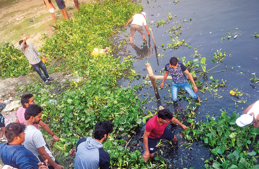 Students clearing water hyacinth from the Gomti in Lucknow
However, the integration of the departments is still missing. Interdepartmental cooperation is required to provide an amalgamation of ideas and actions. It is currently hampered by lack of institutional coherence and policy convergence. This is because there is no vision for integrating the social, hydrological, and ecological components of water governance. The Jal Jeevan Mission intends to provide a tap with water in every home. A huge task to complete as only 16 percent of houses in UP have tap connections. Much of the water is to be tapped from groundwater and rivers. If rivers are not revived, future supplies will be uncertain.
The state’s water future will be jeopardized unless a paradigm change occurs in defining resource endowments and rights, scientific restoration techniques, and coherent institutional and legislative framework with appropriate administrative arrangements.
A POLICY FOR UP
We have to think of ways and means to restore the health of our rivers — our survival is linked to their existence. A good entry point could be through a state river policy. National and state water policies have been unable to ensure long-term protection of rivers and river ecosystems, including ponds, lakes, and wetlands from pollution and encroachments. Policies have also been unsuccessful in encouraging sustainable, equitable, and balanced use of water. The institutions are unable to prevent further depletion of rivers and riverine environments with regard to their ecological water needs.
Being India’s most populous state, UP has significant responsibility to be a first mover in steering policy reform in river rejuvenation. A proactive and forward-looking river policy is desirable with enabling ecosystems on both regulatory and legal fronts in addition to institutional and administrative support. A river policy can provide crucial directives to save water resources as well as directions to resolve conflicts, whether contemporary or in future.
GUIDING PRINCIPLES OF A POLICY
River as a living entity
A river is not simply a water channel. It is much more. Rivers are intricately connected to groundwater, biodiversity, floodplain agriculture and livelihoods. Clearly, the health of rivers won’t have much long-term resilience under the status quo. Many countries have granted legal personhood to their rivers through acts, laws and amendments. If we treat rivers as living systems, our approach will definitely change.
Water for ecosystems
Rivers are part of the hydrological cycle along with plants and animals, forming a wholesome and dynamic ecosystem. We only ‘want’ from the rivers; we never worry about the river’s demand. Water for ecosystems is a legitimate demand. Rivers must flow with a considerate ecological flow volume. The demand for ecosystem and ecological flows must be met while taking water from a river.
Creating water sanctuaries
Just like forest reserves, we need water sanctuaries — areas which serve as critical storage of freshwater naturally. Baghel Tal is one of the biggest water bodies of UP in Bahraich district. It is facing encroachment from all sides. It is not even declared a wetland. Ideally, this should have been a water sanctuary. Similarly, thousands of water bodies in the state are waiting to get legal protection as they are not notified as wetlands. Under a river policy, all such water bodies must get protection through notification as a unit of vital importance.
River basin as a planning unit
The use of water for agriculture cannot be separated from other usage. This necessitates an integrated strategy for river basin planning, management, and operation of water infrastructure. Water planning and management in the basin is hampered by the lack of an integrated data management system that incorporates water accounting, water balance, and water budget analyses performed at the city, block and watershed levels. Wastewater management in urban areas and contaminated hotspots has to be prioritized. Plans for basin-level wastewater management should concentrate on decentralized treatment and reuse solutions. In a certain timeframe, all towns and cities should gradually expand the usage of treated wastewater for appropriate reuse.
River-sensitive master plans
Poor land use planning frequently blocks the drainage of an area, stymies recharge prospects and pollutes groundwater, affecting the health of rivers and aquifers. We need river-sensitive master plans while developing a town or city. Smaller rivers, tributaries, drainage canals, and other bodies of water should be carefully protected while developing a township or a highway. Blue landscapes can co-exist with buildings and roads — provided we are a little careful while planning.
Mapping revenue records
Most smaller rivers and streams have not been mapped correctly. With the advance of satellite and drone technologies, it is now easier to have a digital record of all the connected water bodies of a river channel, adjacent riparian zones and floodplains and how they have been erased from revenue records. If we regain the land belonging to the rivers and ponds, half the battle is won. Land records will be a prime factor in giving justice to water bodies. The issue of acquiring land for river restoration is crucial. For the explicit objective of conservation or the eradication of affecting agents and to assist future restoration operations, we must secure the lease, title, and easements of land along the rivers.
Knowledge base
Due to lack of knowledge about rivers and groundwater connections, groundwater exploitation has had serious implications on river-aquifer interaction along the main stem of the Ganga river and its major tributaries in the state. There is a sharp decline in critical base flow contributions during the dry season, causing a hydrological imbalance in the area. This has affected access to water for irrigation, with a widening gap between demand and supply. Unless the groundwater scenario is improved, revival of smaller rivers will be myth. The piezometer data shows that water level has declined in 73 percent of wells in UP. Until and unless groundwater over-extraction is not checked, rivers cannot get to their original state.
Nature-based solutions
Most complex problems require simple solutions — nature-based solutions are the best. By working around the rivers and their immediate landscape, we can improve the river’s health without spending huge sums of money. River restoration should be taken up scientifically with minimum structural modification of river channels. The focus should be on revitalizing natural processes with a holistic understanding of rivers as natural ecosystems. There are many successful examples of improving fish habitat, water quality, or river recreation opportunities with nature-based solutions.
Enhancing resilience
River restoration can also improve groundwater recharge, mitigate droughts, provide flood buffers, regulate soil fertility and moderate climate. The state action plan on climate change has not given attention to these co-benefits. A resilient river system can endure climatic shock well and protect us from future impacts. By re-establishing the mechanisms required to maintain the natural ecosystem, river resilience improves ecological integrity which quickly restores damaged watersheds in the wake of floods or droughts.
Participatory action
Promoting effective engagement, communication and coherence between policymakers, practitioners and river scientists is very crucial. Gram panchayats are the first level of a decentralized governance system. They need to be mainstreamed with multiple channels of governance. The success of restoration depends on how well restoration efforts are received by the people who live along the river and its floodplain.
Legal framework
An important aspect of river policy is a strong legal framework. No formal legislation outlining ownership and rights over water sources exists in India. River rights come from a variety of laws and traditional beliefs. There is no specific law in our country defining who owns rivers and groundwater. The Environmental Protection Act, 1986, the Water Act, 1974, Wetland Protection Act and so on can come in handy to support river protection. However, a separate legal framework on river conservation and management can be worked out. Our water legislation is rooted in the realities of the 1970s and 1980s. Situations have changed dramatically.
 Land belonging to the river is now in the hands of private owners
NATIONAL APPROACH
India’s economy is expanding, cities are becoming bigger, new industries are coming up, and farmlands have to keep pace with the food basket expectations of a growing population. But our water reserves have not increased — they have remained more or less static, even as users have grown exponentially.
No single department is a custodian of our rivers. While the irrigation department largely ‘owns’ running streams, departments like minor irrigation, groundwater, agriculture, land revenue and so on have major stakes. Not a single department is entrusted for their restoration.
We need to look at the river crisis holistically. When we work towards the restoration of rivers, we receive much more in return. There is a synergy between clean rivers and a healthy economy. Rivers protect us if they are protected.
The rural economy is integrated with clean rivers and a river restoration agenda will yield huge health and economic benefit. To promote scientific and unified management of water resources in the country, a guiding framework should be developed. The states can follow these guidelines and establish institutional structures for river basin management, avoiding administrative overlaps.
Our courts have given numerous judgments to clean rivers, but nothing seems to have worked so far. In fact, with increasing expenditure on pollution control, the situation is only worsening. The National Green Tribunal (NGT) passes the order, it reaches the concerned departments and then the responsible departments start defending themselves instead of working on problem areas and correcting the failures.
A lot of money is wasted on ad hoc controls, rather than developing long-term vision and action plans. To solve the emerging water management challenges, it is necessary to properly examine and adjust issues related to hydrology, ecology, social welfare, and economics. We won’t actually have a single strategy for managing water unless these or similar measures are enacted. The country must put in place a cohesive, strong, and inclusive policy framework to tackle the challenges of protecting rivers.
Venkatesh Dutta is a Gomti River Waterkeeper and a professor of environmental sciences at Ambedkar University, Lucknow
Comments
-

Ashok Sarda - Oct. 5, 2022, 4:34 p.m.
It is a daunting task to all stakeholders but creative models of jal, jungle, jamin, jan, janwar and Sadak seem to be evolving. Need to develop pilots by taking all department's , agri university etc on board.
-
aruna rodrigues - Oct. 1, 2022, 6:39 p.m.
First of all -- thank you for this staggering quality of work and I would like to add, HOLY and spiritual work. The over-riding Q -- how are we going to win yet another battle this time with our rivers, when the Govt. wont hold hands with us. Instead, they are pursuing a path even mor detructive -- linking of rivers? your analyses of the GOMTI makes me shudder as to what the consequences of such a plan might be. Thank you again -- from one Indian among many